Little Giant Peak — a short day out of Arrastra Gulch (Class 2)
Other climbers: Emily Sharpe — not yet · Shawn D Keil — not yet
At a glance — recommended day
8.4 mi · 3,441 ft gain · Class 2 · 1 peak · ~8.81 h drive
NOAA weather link: Arrastra Gulch Weather
CalTopo research map: https://caltopo.com/m/TJ1E14A
Researched: 2026-08-01
Status in Peak Checklist: unclimbed.
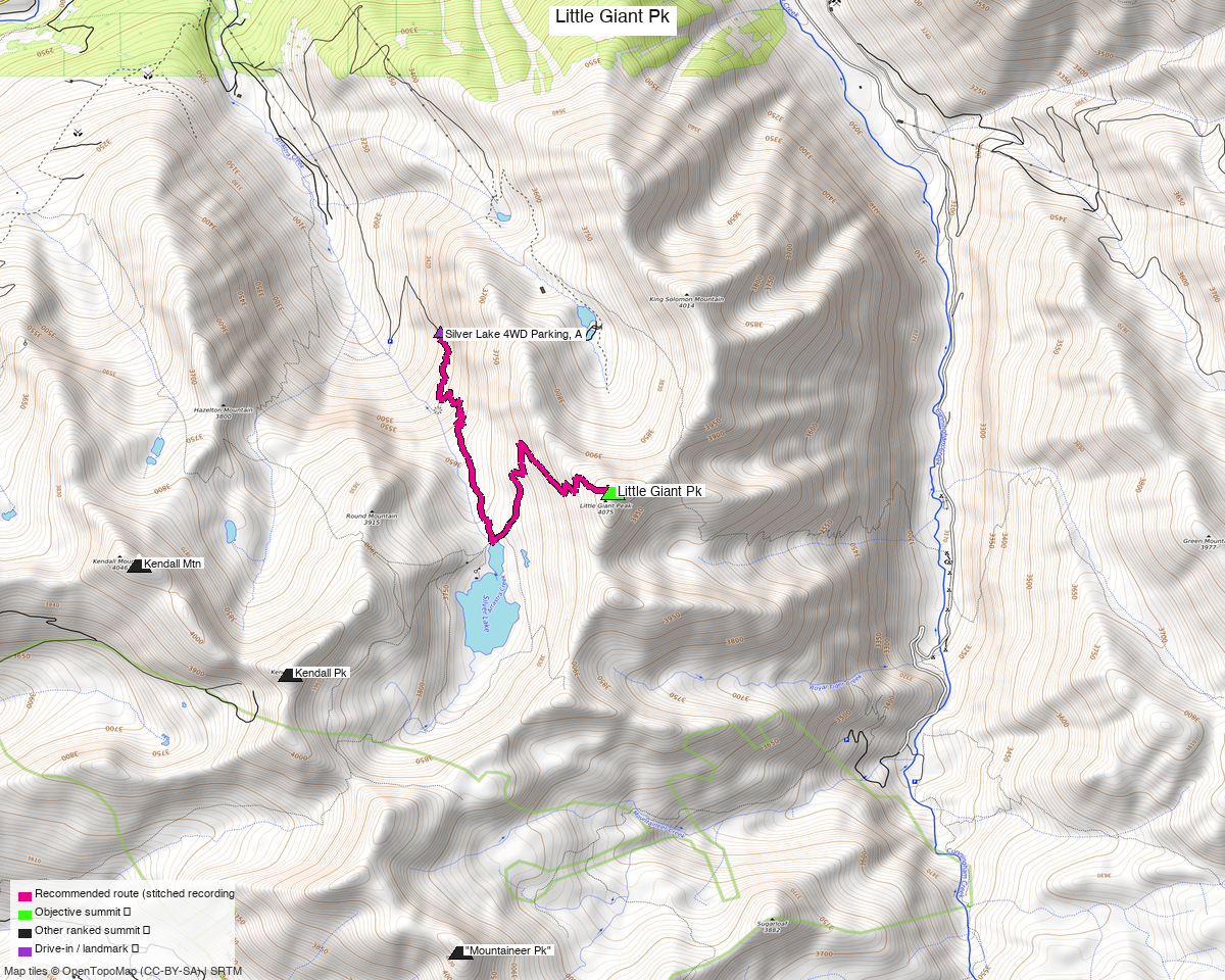
Note: the recommended route was distilled from 8 recorded GPS tracks of real trips (14ers.com · peakbagger · Kyle's recordings) — all layered on the interactive CalTopo research map.
Why this is its own report
Little Giant is one of six unclimbed 13ers on the ridges above Silverton, and it is the one that does not link to the others. The other five — Kendall Mtn, Kendall Pk, Mountaineer, PT 13,117 and PT 13,073 — go together in a single 15.8 mi day from town.
Little Giant sits in Arrastra Gulch, a different drainage, and every recording reaches it from there. Forcing all six into one route produced a 27 mi line with 100%, 96% and 81% retraces between legs. Split, it is an easy half-day.
Little Giant Peak, 13,417', Class 2. San Juan County — San Juan National Forest.
The recommended route — 8.4 mi / 3,441 ft
An out-and-back from Arrastra Gulch, composed from trk_pb_1 (August 2024). Nearly
two-thirds of it is on trail — 69% on the way up, 57% on the way down — and the composer
trimmed 0.45 mi of that party's detour that reached no objective.
For comparison, the other clean recordings run 11.1 mi (trk_14ers_4) and 10.7 mi
(trk_loj_13098) from a start half a mile lower down the gulch. Driving the extra half mile up
CR 21 to 9,950 ft is worth about 2.5 mi.
Getting there — Arrastra Gulch
| Drive from Boulder | ~8h 50m via Google Maps |
| Trailhead | Arrastra Gulch, 37.82034, −107.62032, 9,950' — CR 2 out of Silverton past the Mayflower Mill, then CR 21. |
| Road | CR 21 is surface=gravel, tracktype=grade2. Several unpaved fee=no parking areas along CR 2 / CR 21; no mapped trailhead node. |
| Land | San Juan NF. Kendall Mountain Recreation Area and Silverton Mountain ski areas are in the wider box; neither touches the route. |
Gear & season
- Best window: July through September.
- Terrain: Class 2, and mostly on trail. This is the easiest report on the site by grade.
- Storms: the upper basin is open — normal early start.
Other considerations
Pair it with the Silverton five. That report is 15.8 mi and 5 peaks from town, and its trailhead is 20 minutes down the same road. Two days out of Silverton clears all six unclimbed 13ers in this group for one 8.5-hour drive.
King Solomon Mountain is the natural same-day add-on — one trip report in the pool pairs it with Little Giant from this exact basin. It is unranked, so it does not count toward the list.
Trip reports & GPX (all three sources)
All three sources swept for this peak and deduped, plus the mapped OSM trail network — all layered on the research map.
- 14ers.com: peak 10416 — 4 GPX-library tracks.
- listsofjohn.com: peak 386 — 4 trip reports, all of whose tracks duplicate another source (2 recorded as duplicates). LoJ cross-verified the peakbagger id: 15157.
- peakbagger.com: peak 15157 — 2 ascent tracks with GPS (plus 2 duplicates).
Sources checked: 14ers.com ✓ · listsofjohn.com ✓ · peakbagger.com ✓